

Park to Park: a two-day hike from Morwell National Park to Tarra-Bulga
Two days · 26.9 km on the track, plus 6.4 to 10.3 km to walk out · Challenging, then easy to medium · Camp at Jumbuk Rest Area
Check track conditions before you set out
Sections close for storm damage, harvesting and roadworks. See the latest track conditions on the homepage.
Park to Park starts in Morwell National Park, near Churchill, and crosses the Strzelecki Ranges in Gippsland to Tarra-Bulga National Park. Day one follows Billy’s Creek up a deep, wild valley. Day two follows quiet forestry tracks down to Traralgon Creek and up into Tarra-Bulga. Most walkers camp overnight at Jumbuk Rest Area.
It’s a one-way walk, so arrange a car shuttle between the two parks.
The two days

Day 1: Billy’s Creek section
13.1 km · 7+ hrs · Challenging
Junction Road car park (Morwell National Park) to Jumbuk Rest Area
Day 2: Traralgon Creek section
13.8 km · about 4.5 hrs · Easy to medium
Jumbuk Rest Area to Tarra-Bulga National Park
Day 1: Billy’s Creek section
Junction Road car park (Morwell National Park) to Jumbuk Rest Area · 13.1 km · 7+ hours · Challenging
This is the most challenging part of the Grand Strzelecki Track.
- Koalas live in the tall Manna Gums along the creeks and Mountain Grey Gums on the slopes.
- Billy’s Creek has rock pools, cliffs and small waterfalls. Freshwater crayfish, trout, eels and platypus live in the creek.
- Billy’s Creek Falls is a good lunch stop.
- There are 57 creek crossings. Most are no deeper than your ankles, but the creek can rise quickly in heavy rain.
- The first 2.2 km, to Billy’s Creek Weir, is easy. Above the falls the track gets steeper and can be overgrown. The climb out of the valley is steep and slippery when wet.
Day 2: Traralgon Creek section
Jumbuk Rest Area to Tarra-Bulga National Park · 13.8 km · about 4.5 hours · Easy to medium
Mostly vehicle tracks with moderate slopes.
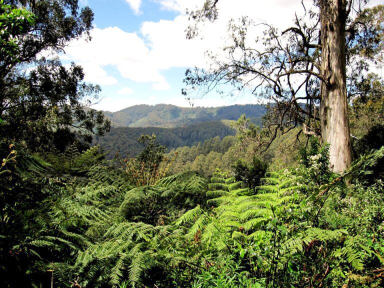
- A dense tree fern gully soon after you leave camp.
- Views of tall forests, small creeks (some with waterfalls) and the mountains as you wind down into the valley. A scenic view is a 700 m detour off the track.
- Koala habitat among large Blue Gums.
- Cross Traralgon Creek at a ford, the lowest point of the day, then climb into Tarra-Bulga National Park.
- Much of the day passes through regrowth from the 2009 fire. Take care near dead trees in strong winds.
Walking out
Day 2 ends at the Mountain Hickory Track junction, just inside Tarra-Bulga National Park. There’s no road here. Carry on to one of these:
| To | Distance | Time |
|---|---|---|
| Pattison Rest Area (Balook) | 6.4 km | 2 hours |
| Balook, via Goombala Road and Drysdale Road | 9.1 km | 3 hours 30 minutes |
| Tarra Valley Retreat (caravan park), via Butler’s Track (part of the Tarra Valley Loop) | 10.3 km | 3 hours 45 minutes |
Is it for you?
This is a remote walk. Carry the right gear, and only go if you have some hiking experience and a reasonable level of fitness. Start day one early so you have daylight to spare. Fallen trees and landslips are possible after strong winds or heavy rain.
Just want a short walk? Walk the first 2.2 km of day one, from Junction Road car park to Billy’s Creek Weir, and back. It’s easy walking on a vehicle track.
Walkers’ stories
Read Matthew’s multi-day walk, An undiscovered gem (2021), which includes Park to Park and a night at Jumbuk. Snakes are about in warmer months: see Dan’s tiger snake in Morwell National Park (2020).
Stories describe the track at the time. Check the homepage for current conditions before you go.
Facilities

- Junction Road car park (start): parking, toilet, picnic area and information.
- Jumbuk Rest Area (overnight): covered and uncovered tent sites, water tanks, a table and a composting toilet. The water isn’t drinkable, so treat it first. No booking needed: it’s first come, first served, for walkers with swags or small tents only.
- Between Jumbuk and the finish: no facilities marked.
Walkers only. The Billy’s Creek section isn’t suitable for mountain bikes.
Getting there
Day one starts at the Junction Road car park in Morwell National Park, at Jeeralang Junction, about 5 km south of Churchill. It’s about 15 minutes’ drive from Morwell, 20 minutes from Traralgon and 25 minutes from Moe. Churchill is about 2 hours east of Melbourne via the Princes Freeway (take the Churchill and Federation University exit).
Get the maps
This page gives you a feel for the walk. For the route, marker posts, side tracks and emergency exits, use the printed maps. Maps 1 and 2 cover Park to Park.
- Printed Topographic Map Set of 6 (covers the whole track, including Park to Park)
- Grand Strzelecki Track planning map (digital download)